List of States and Union Territories in India
Introduction
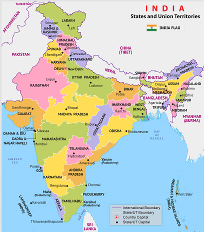
India is the World's second most populous country and the "7th largest" country overall. Twenty-eight states and eight union territories make India's union of states. India is a union of states, and each State's executive head is the Governor, who serves as the President's representative. In India, each State has a capital that acts as the legislative, executive and judicial centre. In other countries, the capital serves as the centre for all three functions. It is a state with a separate chief minister. A state has a distinct, autonomous government. The state government handles security, healthcare, governance, revenue generation, and other state-related activities. This article will discuss these states and union territories in detail.
States of India
In all, India has twenty-eight States:
1. Andhra Pradesh: This State was the first to be established based on a language. Amrawathi is Andhra Pradesh's capital city. On October 1, 1953, the State of Madras was divided to create Andhra Pradesh. On June 2, 2014, Andhra Pradesh was split into a new state called Telangana. Furthermore, Andhra Pradesh is referred to as the 'Kohinoor' of India and the 'Egg Bowl of Asia'. The two main rivers that traverse Andhra Pradesh are the Krishna and Godavari.
2. Arunachal Pradesh: Formerly known as the 'North-East Frontier Agency' (NEFA), Arunachal Pradesh became a state on February 20, 1987. Arunachal Pradesh's capital city is called "Itanagar." Regarding land size, Arunachal Pradesh is the largest of the 7 Sister States of Northeast India. Arunachal Pradesh and China's Tibet Autonomous Region are separated by 1,129 kilometers of the border.
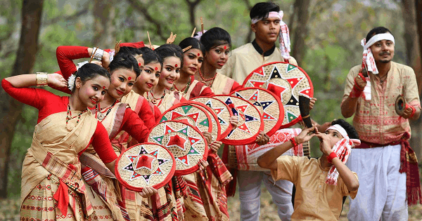
3. Assam: Assam is a state in northeastern India. Dispur, the capital of Assam, is one of India's seven sister cities. Assam tea & silk are well-known products of Assam. Asia's first oil drilling location is available in Assam. In Assam, one-horned Indian rhinos can be found. The Sal trees that blanket the entire State make it look green all year long and help to explain why it gets much rain.
4. Bihar: This State is found in the country's east, India's fourth-most populous sub-national entity and the third-most populous State. Patna is the capital of Bihar. On November 15, 2000, Jharkhand was created by the cession of Bihar. Bihar is divided into three distinct regions based on its structural composition. The Gangetic Plain of Bihar, the southern plateau, and the Shivalik region.
5. Chhattisgarh: This central Indian State is encircled by forests. Chhattisgarh's capital is Raipur. Its seven bordering states are Uttar Pradesh, Madhya Pradesh, Maharashtra, Jharkhand, Odisha, Telangana, and Andhra Pradesh. The State was a portion of "Madhya Pradesh" before it was formed on November 1, 2000.
Chhattisgarh has a tropical climate because of the abundance of flora. The Gaurlata in Samri is Chhattisgarh's highest point. Deciduous woods cover 44% of the State.
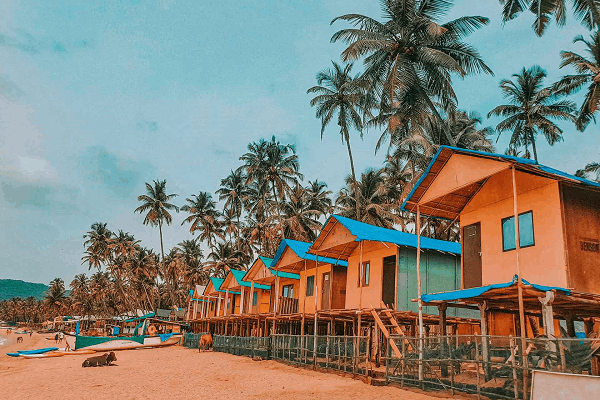
6. Goa: Goa is a state on India's west coast. Goa's capital is Panaji, situated halfway between Karnataka and Maharashtra. It is the tiniest State in India and ranks fourth in population. Goa is one of India's most well-liked travel destinations, and it receives a sizable proportion of national and international visitors each year. The 'northwestern Ghats' rainforest, a rare biodiversity hotspot of the World, is located quite close to the Arabian Sea, which forms the country's western shore.
7. Gujrat: Located primarily on the Kathiawar peninsula, Gujrat features India's longest coastline. By area, it is India's fifth-largest State. Madhya Pradesh, Rajasthan, and Maharashtra surround Gujarat. Gujarat is regarded as one of the states with the highest levels of industrial development and lowest unemployment rates.
Gandhinagar serves as Gujarat's capital. One of the most well-known places we have heard about in that State is the Rann of Kutch, where Rann means desert in Gujarati.
8. Haryana: Established on November 1, 1966, Haryana is a state in the country's north. ' 32 special economic zones' can be found in Haryana. India's main automotive and information technology centre is Gurgaon, in the State of Haryana. Chandigarh, the state capital, is known for its historical landmarks, cultural heritage, and tourism. The villages of 'Rakhigarhi' in Hisar district & Bhirrana in Fatehabad district in Haryana are home to some of the oldest ancient Indus Valley Civilization artifacts in the World.
9. Himachal Pradesh: This State, situated in the 'western Himalayas', is in the nation's northern region. Jammu & Kashmir' Ladakh, Punjab, Haryana, Uttarakhand, & Uttar Pradesh are bordered by it. Agriculture, horticulture, hydropower, and tourism make up the State's economy.
90% of Himachal Pradesh's residents reside in rural areas covered with mountains and rivers. Shimla, the capital of Himachal Pradesh, is a popular tourist destination in India.
10. Jharkhand: This Indian State is located in the east. West Bengal, Uttar Pradesh, Bihar, Odisha, & Chhattisgarh are border neighbors of the states. According to the area, it is India's fifteenth-largest State. Ranchi is Jharkhand's capital. 40% of India's mineral resources come from the State of Jharkhand. In terms of economic growth, it is one of the top states in India. Around Jharkhand, there are numerous hills and rivers. A Palash flower blooms in the fall, making Jharkhand's skies more cheerful.
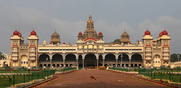
11. Karnataka: On November 1, 1956, it was established. The State is situated in India's southwest, and Bangalore serves as Karnataka's capital. Its neighbours include Goa, Maharashtra, Telangana, Andhra Pradesh, Tamil Nadu, and Kerala. It is the 'sixth-largest' State in the region and India's eighth-most populous State. Karnataka is divided into 31 districts. Kannada is the predominant language spoken in the State, followed by Tamil, Telugu, Malayalam, Kodava, and Beary.
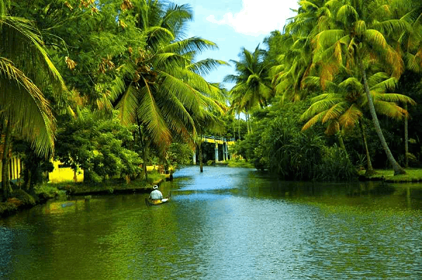
12. Kerala: Kerala was founded on November 1, 1956. According to the area, it is India's 21st-largest State. Tamil Nadu & Karnataka are two of the states that it borders. Thiruvananthapuram is the State's capital and one of its 14 districts. Malayalam, which is also the State's official language, is the language that is most often spoken in Kerala. Kerala is also called God's nation, the spice gardens of India, the coconut kingdom, and the crown jewel of South India.
13. Madhya Pradesh: Madhya Pradesh was established on January 26, 1950. Due to its location in the middle of India, Madhya Pradesh received its name. Bhopal is Madhya Pradesh's capital. The people, food, and culture of Madhya Pradesh are well-known. Madhya Pradesh's official language is Hindi. Madhya Pradesh is encircled on all sides, and the massive Kumbh Mela fair is held once every 12 years. Madhya Pradesh's Khajuraho temples are well-known.
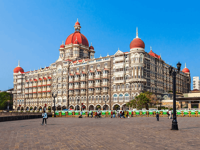
14. Maharashtra: This State was created on May 1, 1960, and its official language is Marathi. It is associated with the Western Ghats. Maharashtra is recognized as the entrance to India's heart. Maharashtra is the second-most populous and third-largest State in the nation. Maharashtra has a long history and a diverse way of life. Shirdi and Panchgani are some of the spiritual & adventurous locations in Maharashtra. Mumbai is Maharashtra's capital.
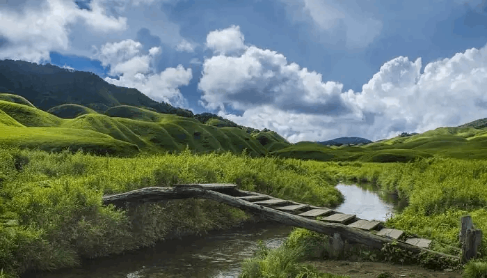
15. Manipur: One of India's most stunning states, Manipur is also referred to as the "jewel city of India." It was established in 1972 on January 21. Manipur is one of India's top tourist destinations as well. It features unusual topography with lush, blue lakes and green values. Manipur's Curb Lamjao National Park, the only 'floating national park' in the World, is a popular tourist destination. Imphal is Manipur's capital city.
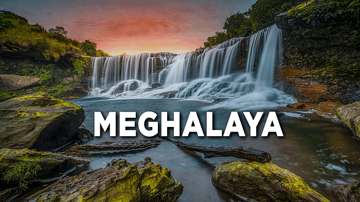
16. Meghalaya: Meghalaya was established on January 21, 1972, and English is the official language there. Meghalaya is one of India's "seven sisters" in the northeast. Cherrapunji, in Meghalaya, is well recognized for having the 'most rainfall' worldwide. Like another state in the northeast, Meghalaya boasts breathtaking vistas with hills, lakes, and waterfalls. Shillong is Meghalaya's capital.
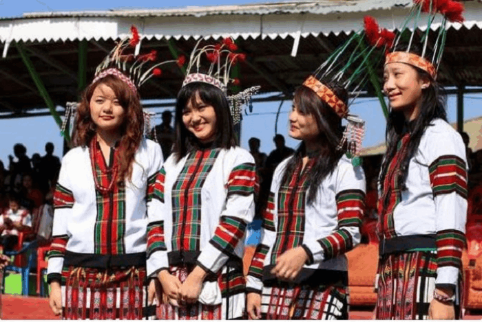
17. Mizoram: A northeastern state created on February 20, 1987, Mizoram is one of the seven sisters. The festivals and culture of Mizoram are considerably different from those of the rest of India. Aizawl, the biggest city in Mizoram, is the nation's capital. Indians must purchase an inner line permission, which costs '170 rupees for a 15-day pass, to enter Mizoram.
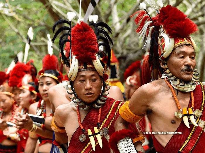
18. Nagaland: This State is sometimes called the 'Switzerland' of the East. The Northern State of Nagaland, one of India's "seven sisters," was established on December 1, 1963. Dimapur, Nagaland's largest city, is the nation's capital. The fascinating aspect of Nagaland is its food; its residents eat practically anything they can find, including elephants, dog pokes, and snails. Nagaland is known for its rich cultural traditions, unusual cuisines, and colourful attire.
19. Odisha: Located on the Indian subcontinent's east coast. The State's capital is Bhubaneswar. One of the notable states in the nation with contemporary facilities and infrastructure in Odisha. Significant efforts have been made since the State's independence to develop its rural areas. Odisha is regarded as "the country of temples" and has a rich cultural heritage. The State is also home to several unusual temples. The traditional Odissi dancing style is the main attraction in this area.
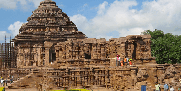
Major rivers like the Mahanadi, Brahmani, & Bansadhara flow through the State. The Eastern Ghats' hills and mountains comprise three-fourths of the total State.
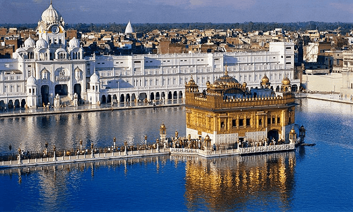
20. Punjab: The word "Punjab" means "five rivers," and there is a network of five rivers, including the Sutlej, Chenab, Ravi, Bees, and Jhelum. Punjab is located in India's northern region. ' Punjabi' is the official language of Punjab, and Chandigarh is the State's capital. Punjab was created on November 1, 1966. Punjab is considered to be India's "golden state" due to its extensive farming and cultivation activities.
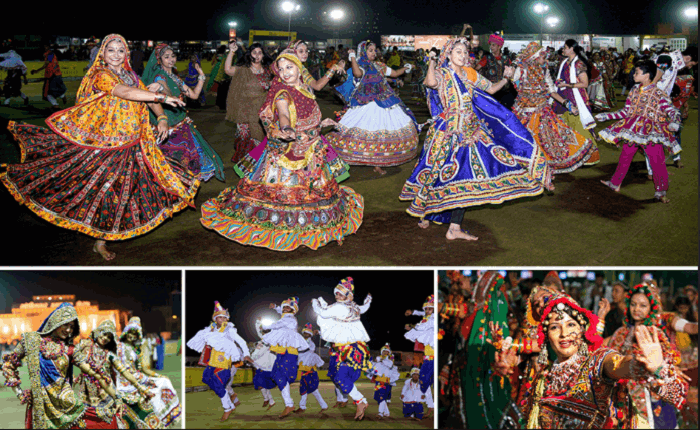
21. Rajasthan: The capital of Rajasthan is Jaipur, and the State was founded on January 26, 1950. Rajasthan is one of India's most vibrant and colorful states, pulling tourists from all over the World who come to experience its history, music, cuisines, and friendly locals.
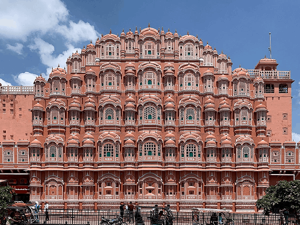
Rajasthan, in India's northern area, is frequently referred to as the "land of the kings." Old forts are a highlight of Rajasthan.
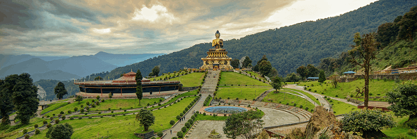
22. Sikkim: Sikkim is considered India's "smallest state." It was formed on May 16, 1975, and its official languages are Nepali and English. Sikkim is situated in northeastern India, with Gangtok as its capital and central city. Sikkim is a popular tourist destination and is home to a wide range of wildlife, flora, rivers, lakes, and waterfalls. In Sikkim, people can experience historical monasteries, orchid nurseries, and hiking trails. Sikkim is the ideal vacation spot in India.
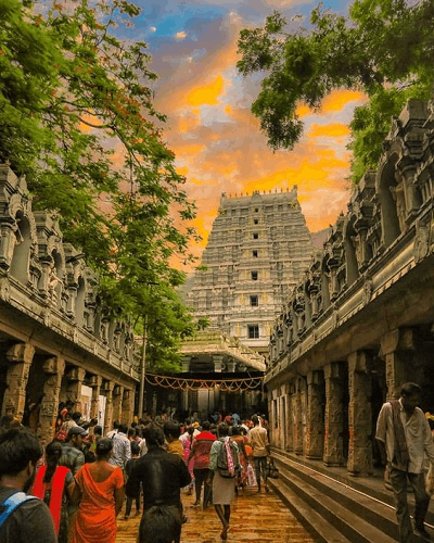
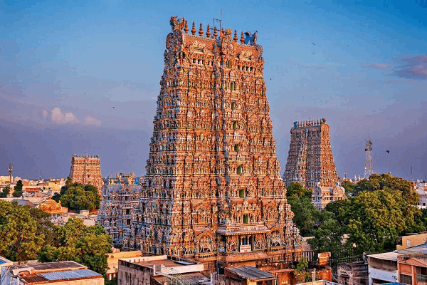
23. Tamilnadu: Chennai, the State's largest city, serves as its administrative centre. Tamilnadu is located in India's south, and the primary language of Tamilnadu is Tamil. The State was established in 1956 on November 1. The immense history and natural beauty of Tamil Nadu will charm you. Tamil Nadu is a land rich in culture and religious heritage and one of the top tourist destinations for pilgrimage. The southernmost part of India, Kanyakumari, located in Tamilnadu, is well-known for its beach, the thundering Thirparappu Falls, and other attractions.
24. Telangana: Hyderabad, the capital of Telangana, is the State's largest city. Telangana is the newest State in India. The region was separated from Andhra Pradesh's northwest on June 2, 2014. Telugu is the official language of Telangana, which was previously a part of the area that included Hyderabad in Andhra Pradesh. Since its separation, Telangana has developed a unique identity rich in history and culture. Hyderabad, which Telangana shares with Andhra Pradesh, is its capital.
25. Tripura: This State was established on January 21, 1972, and is situated in the northeastern region of India. Its capital is Agartala, and Bengali and Oakbrook are the official languages. It is located at the base of the Himalayan mountains, initially serving as the legendary Mania tribe's ancestral home.
Tribal and contemporary Bengali cultures are uniquely merged in Tripura. In the northeastern region of India, Tripura is also a well-liked tourist destination.
26. Uttarakhand: The popular nickname for Uttarakhand is "dev bhumi," or "country of the gods." It was established on November 9, 2000, and is situated in India's northern region. Uttarakhand's State, known initially as Uttaranchal, is noted for its natural beauty and spirituality. Rhododendron, silver fir, and oak trees may be abundant there. Since Uttarakhand is where the Ganga & Yamuna rivers originate, it is a favorite destination for pilgrims.
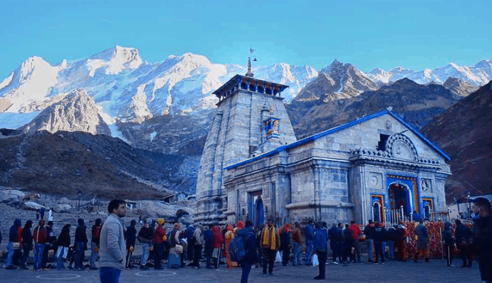
Uttarakhand is home to the four holiest Hindu pilgrimage sites: 'Gangotri', 'Yamunotri', 'Kedarnath', & 'Badrinath'. Each year, thousands of pilgrims undertake the Char Dham journey to Uttarakhand.
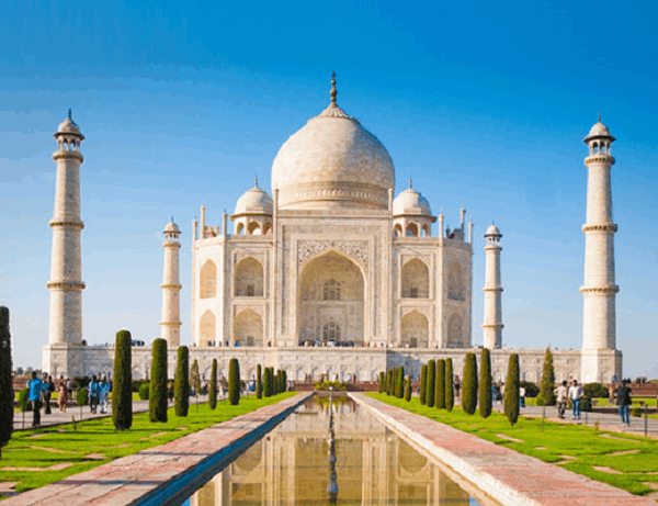
27. Uttar Pradesh: Uttar Pradesh is the most populous State in India, home to almost 200 million people. In 1950, it was established one year after India became a republic. India is a renowned travel destination thanks to the Taj Mahal, one of the seven "Wonders of the World," in Agra, Uttar Pradesh.
In the State's western centre, Lucknow is the capital. One of the eight types of Indian classical dance, known as Kathak, has its roots in Uttar Pradesh. Uttar Pradesh is sometimes referred to as 'The Heartland of India' because it is located in the country's centre.
28. West Bengal: Located in Eastern India, this State is considered the melting pot of cultures and the fourth most populated nation. With five separate states encircling it, Kolkata, the State's capital, is frequently referred to be India's cultural centre. West Bengal's combination of many languages, religions, cultures, traditions, cuisines, and lifestyles adds a distinctive flavour to India's diversity.
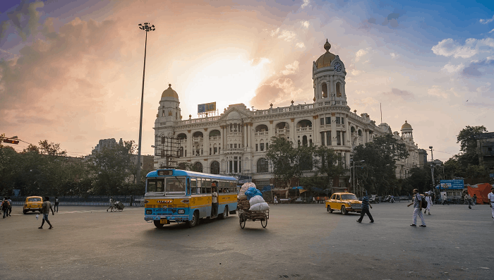
Bengal has all a state needs to prosper, bordered by the splendour of the Himalayan peaks in the north & sweetened by the sea in the south. West Bengal, India's second-largest tea-producing State, is where the well-known Darjeeling tea type is grown. Bengal is the State that produces the most rice in India.
Union Territories of India
In all, India has eight union territories:
1. Andaman and Nicobar Islands: The 'Andaman & Nicobar Islands', a union territory of India made up of 572 islands, 37 inhabited, are located at the confluence of the "Bay of Bengal" and the "Andaman Sea." The area around 150 km north of 'Aceh' in Indonesia is divided between Thailand and Myanmar by the Andaman Sea. The Andaman Sea & the Bay of Bengal are to this region's east and west.
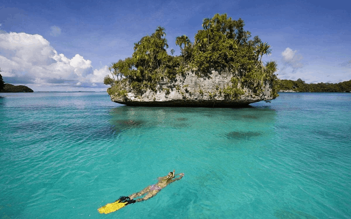
The capital of the territory is the city of 'Port Blair'. The islands' total land area is approximately 8,249 km2. The attractiveness of beaches and adventure activities like snorkelling and sea walking drive tourism to the Andaman & Nicobar Islands.
2. Chandigarh: Chandigarh is an Indian city and union territory. The states of Punjab border the area on the other side and Haryana on the east. It is situated around 265 km north of New Delhi. Chandigarh, one of India's first planned cities after independence, is well-known worldwide for its urban planning and architecture. It has one of the highest per capita incomes in the country.
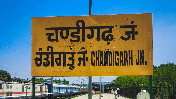
The union territory has one of the highest Human Development Indexes among Indian states and territories. The majority of Chandigarh is encircled by extensive eucalyptus and banyan plantations. The forest habitat supports a variety of trees, including Ashoka, cassia, and mulberry.
3. Dadra and Nagar Haveli & Daman and Diu: Along with Goa, Dadra and Nagar Haveli & Daman, and Diu were colonized by Portugal until 1954. Dadra & Nagar Haveli had its government from 1954 to 1961, when it was incorporated as a union territory. The semi-enclaves of 'Daman and Diu' were a part of the Goa, Daman, and Diu Union Territory from 1961 till Goa became a state of India in 1987.
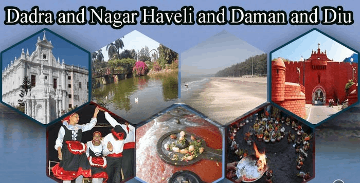
Dadra and Nagar Haveli and Daman and Diu were two autonomous union territories of India from 1987 till a bill combining the two regions into one was passed in 2020. Most people in this union territory can understand and speak this region's official languages: English, Gujarati, Hindi, and Marathi.
4. Delhi: Delhi is a metropolis and the national capital of India. Old Delhi, a historically significant city in the north, & New Delhi, the nation's capital since 1947 and a metropolis founded in the early 20th century as the seat of British India, make up Delhi. Delhi has historically been significant as the nation's political capital and a hub for trade, transportation, and culture.
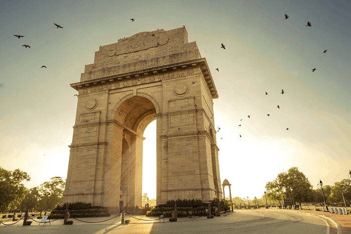
The region's first-century BCE ruler, Raja Dhilu, is said to be the inspiration for the city's name. Many of the terms used to refer to the town, such as Delhi, Dehli, Dilli, & Dhilli, are probable misspellings of his name. In addition to Haryana, Delhi also has a boundary with the State of Uttar Pradesh in other directions.
5. Jammu and Kashmir: The Indian subcontinent's Jammu and Kashmir area is centred on the plains surrounding Jammu to the south and the Vale of Kashmir to the north. It is a union territory of India (a state until October 31, 2019). The union territory is a portion of Kashmir, a larger area that has been the source of conflict between India, Pakistan, & China ever since the subcontinent was divided in 1947. The framework for reducing Jammu and Kashmir's status from statehood to union territory and separating the Ladakh area into a separate union territory was established by legislation passed in August 2019.
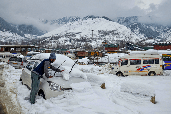
The modification became effective on October 31 of that year. Still, various court issues about its legal validity lingered in the years that followed. Jammu is the wintertime capital, whereas Srinagar is the summertime one.
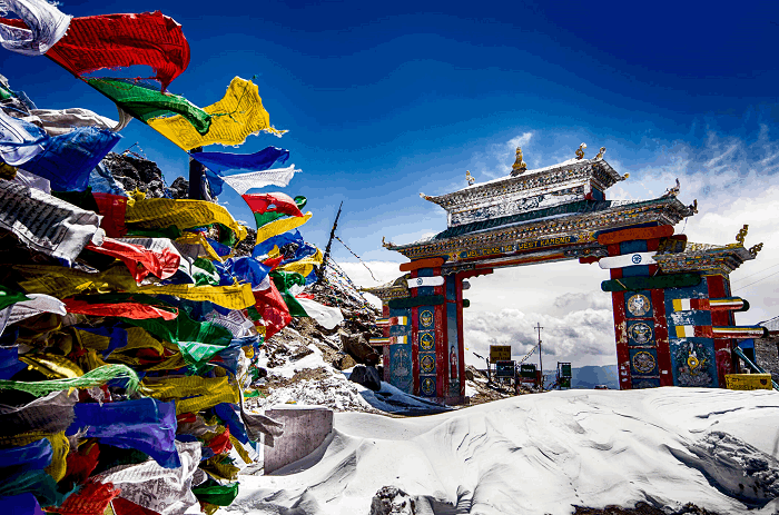
6. Ladakh: A considerable portion of the northern & eastern Kashmir region is located northwest of the Indian subcontinent, and China also administers a portion of northeastern Ladakh. Ladakh has been divided administratively between Pakistan (northwest), a part of 'Gilgit-Baltistan', and India (southeast), a part of the Ladakh Union Territory.
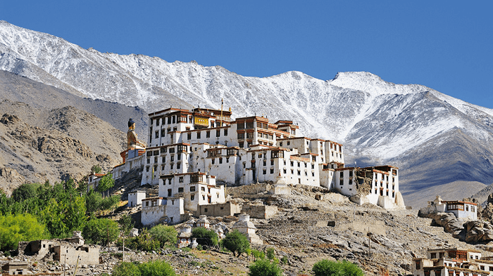
The upper Indus River valley and the Ladakh Range, a southern extension of the Karakoram Range, are located within the roughly '45,000 square miles' (117,000 square km) of Ladakh. Ladakh is one of the highest places on earth, and high plains and steep valleys make up most of its natural characteristics.
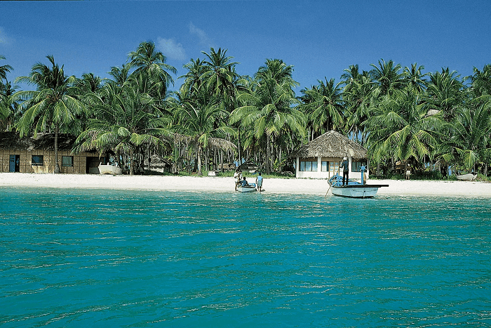
7. Lakshadweep: With barely 32 km2, Lakshadweep is India's shortest union territory and one of just two administrative regions, with a majority of Muslims (the other being Jammu & Kashmir). Translated from Sanskrit, the name means "a hundred thousand islands" (Laksha = lakh, or 100,000, and dweep = island). Peak season, when it's cooler and drier, lasts from December to May.
The central (southwest) rainy season lasts from May to September, while the northeast monsoon season in October and November can sometimes be rainy. The islands' inhabitants are of mixed Indian & Arab ancestry and share racial similarities with the people of Kerala.
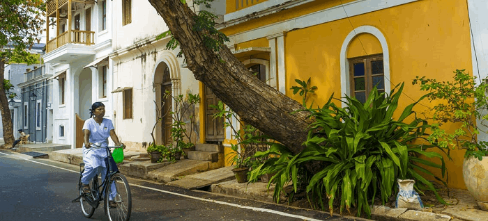
8. Puducherry: Previously known as Pondicherry, also written Pondichéry, Puducherry is a union territory in India with the original name Putucceri. It was created in 1962 from the amalgamation of India's four former French colonies: Pondicherry (now Puducherry), Karaikal, Yanam, and Mahe. Yanam is located further north along India's eastern coast in the Godavari River delta region. In contrast, Mahe is situated on the country's western Malabar Coast and is surrounded by Kerala state. The territory's capital is Puducherry, located north of Cuddalore in the Puducherry sector.